Invariant spatial information in sketch maps — a study of survey sketch maps of urban areas
Keywords:
spatial cognition, VGI, knowledge representationAbstract
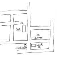
It is commonly recognized that free-hand sketch maps are influenced by cognitive impacts and therefore sketch maps are incomplete, distorted, and schematized. This makes it difficult to achieve a one-to-one alignment between a sketch map and its corresponding geo-referenced metric map. Nevertheless, sketch maps are still useful to communicate spatial knowledge, indicating that sketch maps contain certain spatial information that is robust to cognitive impacts. In existing studies, sketch maps are used frequently to measure cognitive maps. However, little work has been done on invariant spatial information in sketch maps, which is the information of spatial configurations representing correctly the real world. We aim to study such information from a cognitive perspective. This paper first presents basic spatial objects identified in sketch maps and then introduces sketch aspects that capture invariant spatial information. The accuracy and reliability of these aspects were evaluated by a human study. We collected sketch maps from participants, extracted and measured spatial relations of identified spatial objects, and in the end analyzed the accuracy and statistical significance of these relations. Based on the statistical survey, we propose in this paper a set of seven sketch aspects that constitute invariant spatial information, along with a spatial analysis method to measure them. The findings of these aspects help to understand which spatial information is preserved under the transformation from the physical world to human sketch maps.

Downloads
Published
Issue
Section
License
Copyright (c) 2015 Jia Wang, Angela Schwering

This work is licensed under a Creative Commons Attribution 4.0 International License.
Articles in JOSIS are licensed under a Creative Commons Attribution 3.0 License.
