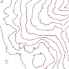
Locally adjusted curve approximation smoothing of contour polylines
DOI:
https://doi.org/10.5311/JOSIS.2024.28.245Keywords:
terrain modeling, terrain model error, smoothing contour lines, smoothing contour line error, geomorphometry, incremental self-similar line smoothing algorithm, medial axis computation, measures of contour line smoothness and symmetryAbstract
Numerically interpolated contour lines (NICL) developed from a high-resolution, accurate digital elevation model (DEM) can be considered the most accurate contour baseline available from surveyed data. Displays of this baseline, however, can exhibit an undesirable angularity and clutter that impedes human understanding of the data and defies the universal appeal of a smooth curve. To achieve smooth, readable lines, the prevailing wisdom today is to either 1) smooth the underlying surface model before creating the lines or 2) use mathematical methods adapted from computer-aided design (CAD) to smooth the lines in x and y. However, these smoothing methods can result in an inaccurate rendition of the original data that undermines their subsequent use in analysis and modeling applications. Upon close inspection, lines generated from such methods can depart from the baseline by more than a definable and acceptable distance in x and y, particularly noticeable in important areas of slope change. Here, we argue that generalized contours have a geometric accuracy requirement that must be observed. We present a novel alternative to the prevailing methods that 1) presents an incremental smoothing method that is a logical complement to Douglas-Poiker thinning; 2) introduces the use of slope as a means of controlling the degree of smoothing locally; 3) produces novel, operational definitions of tests for smoothness and accuracy as well as for line symmetry; and 4) introduces the notion of a topological TIN as a new type of terrain model and a medium for edits of contours. The method only manipulates the baseline contours in x and y. By using only simple proportions of sides and self-similar geometry to smooth the original lines, we at the same time impose computable, dynamic constraints on the smoothing. This combination ensures the accuracy and acceptability of the final contours at scales appropriate for working GIS displays. The result is a Locally Adjusted Curve Approximation (LACA) technique for contour line smoothing.

Downloads
Published
Issue
Section
License
Copyright (c) 2024 Stephan Miller

This work is licensed under a Creative Commons Attribution 3.0 Unported License.
Articles in JOSIS are licensed under a Creative Commons Attribution 3.0 License.
